SOLOMON ISLANDS

SOLOMON ISLANDS

SOLOMON ISLANDS

SELECT YOUR NATIONALITY

– No current scheduled consular closures.
CONSULAR CLOSURES
TBC.
TOP ATTRACTIONS
PLEASE CLICK / HOVER ON THE IMAGES BELOW FOR MORE INFORMATION.
Name: Coral Triangle
Location: Solomon Islands
The Coral Triangle is a roughly triangular area of the tropical marine waters of Indonesia, Malaysia, Papua New Guinea, Philippines, Solomon Islands and Timor-Leste that contain at least 500 species of reef-building corals in each ecoregion. This region encompasses portions of two biogeographic regions: the Indonesian-Philippines Region, and the Far Southwestern Pacific Region. The Coral Triangle is recognized as the global centre of marine biodiversity and a global priority for conservation. It is also called the "Amazon of the seas" and covers 2,200,000 sq mi of ocean waters. Its biological resources sustain the lives of over 120 million people. According to the Coral Triangle Knowledge Network, about $3 billion in fisheries exports and another $3 billion in coastal tourism revenues are derived as annual foreign exchange income in the region.

The WWF considers the region a top priority for marine conservation, and the organization is addressing the threats it faces through its Coral Triangle Program, launched in 2007. The center of biodiversity in the Triangle is the Verde Island Passage in the Philippines, while the only coral reef site declared as a UNESCO World Heritage Site in the region is the Tubbataha Reef Natural Park, also in the Philippines.

SOURCE: https://en.wikipedia.org/wiki/Coral_Triangle
Name: Guadalcanal
Location: Solomon Islands
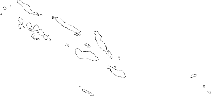
Guadalcanal is the principal island in Guadalcanal Province of the nation of Solomon Islands, located in the south-western Pacific, northeast of Australia. The island is mainly covered in dense tropical rainforest and has a mountainous interior.

Guadalcanal's discovery by westerners was under the Spanish expedition of Álvaro de Mendaña in 1568. The name comes from the village of Guadalcanal, in the province of Seville, in Andalusia, Spain, birthplace of Pedro de Ortega Valencia, a member of Mendaña's expedition.

During 1942–43, it was the scene of the Guadalcanal Campaign and saw bitter fighting between Japanese and US troops. The Americans were ultimately victorious. At the end of World War II, Honiara, on the north coast of Guadalcanal, became the new capital of the British Solomon Islands Protectorate.

SOURCE: https://en.wikipedia.org/wiki/Guadalcanal
Name: Lau Lagoon
Location: Malaita, Solomon Islands
Lau Lagoon is located on the northeast coast of Malaita Island. The lagoon is more than 35 kilometers long and contains about 60 artificial islands built on the reef. It is home to a number of different villages, the largest of which is Forau. Forau has around 1,500 permanent residents but can swell to three times that number during important local feasts or religious holidays (e.g. Christmas, Easter). The road from Auki, which passes through Malu'u, ends at Fouia wharf opposite the islands of Sulufou and Adagege in the Lau Lagoon. The Lau Lagoon is otherwise only accessible by sea.

The people of the Lau Lagoon call themselves wane i asi 'salt-water people' as distinct from wane i tolo 'bush people' who live in the interior of the island. There was a history of conflict between the bush people and the salt-water people. The people of Lau Lagoon build islands on the reef as these provided protection against attack. These islands were formed literally one rock at a time. A family would take their canoe out to the reef which protects the lagoon and then dive for rocks, bring them to the surface and then return to the selected site and drop the rocks into the water. The Lau people continue to live on the reef islands.

SOURCE: https://en.wikipedia.org/wiki/Lau_Lagoon
FLIGHT TIMES / MAJOR CITIES
PLEASE SEE BELOW MAJOR CITIES IN SOLOMON ISLANDS / CLICK OR TOGGLE BELOW FOR FASTEST AVERAGE FLIGHT TIMES FROM UK.
COUNTRY INFORMATION GUIDE
PLEASE SEE BELOW FACTS, USEFUL UK GOVERNMENT TRAVEL LINKS AND BUSINESS VISITOR ACTIVITIES, FOR TRAVEL TO SOLOMON ISLANDS.
FACTS:
Official Languages: English
Currency: Solomon Islands Dollar (SBD)
Time zone: SBT (Solomon Islands Time) (UTC+11)
Drives on the right
Calling code: +677
Local / up-to-date weather in Honiara (and other regions): BBC global weather – click here
UK GOVT TRAVEL LINKS:

For more useful information on safety & security, local laws / customs, health and more, please see the below official UK .gov (FCO) web link for Solomon Islands travel advice. NB: Entry requirements herein listed are for UK nationals only, unless stated otherwise.

You can also find recommended information on vaccinations, malaria and other more detailed health considerations for travel to Solomon Islands, at the below official UK government Travel Health Pro weblink.

BUSINESS VISITOR ACTIVITIES*:
Activities you may undertake on a business visa / as a business visitor:
PERMISSIBLE
ATTENDING MEETINGS / DISCUSSIONS: TBC
ATTENDING A CONFERENCE: TBC
RECEIVING TRAINING (CLASSROOM-BASED): TBC
NON-PERMISSIBLE
AUDIT WORK: TBC
PROVIDING TRAINING: TBC
PROJECT WORK: TBC
*This information does not constitute legal advice and is not an exhaustive list. For a full legal assessment on business visitor activities, please revert to your internal company legal team / counsel.
TRAVEL INFORMATION**
It is highly recommenced that you access the above official UK .gov (FCO) web link and read all safety & security information prior to making your travel arrangements / planning your trip.
PLEASE CLICK / TOGGLE BELOW FOR USEFUL TRAVEL INFORMATION TO SOLOMON ISLANDS.

The currency of the country is the Solomon Islands dollar, denoted by the symbol “SI$” (ISO currency code: SBD). It is divided into 100 cents. Banknotes are issued in denominations of $5, $10, $20, $50, $100, and coins in denominations of 10, 20, 50 cents, $1, $2.

ATMs are available in Honiara. Australian dollars are accepted at some hotels and resorts.

AUKI FERRY:

This runs most days from Honiara Wharf to Auki on the island of Malaita across the Slot from Honiara. In 2012 the fare as SI$300 one way or SI$580 return. The ferry travels through the Florida Islands channel which is worth seeing and there’s a high chance you’ll see plenty of flying fish if you look off the front or sides of the boat. The catamaran ferry is a former Auckland Harbour ferry so is not designed to be ocean-going. This means that when it’s rough, it’s rough so be prepared. The ferry has plenty of comfortable seating, air conditioning and a big flat screen which shows films during the journey. You can buy drinks and snacks on the ferry although it’s best to buy this on the way out from Honiara as supplies run low once the boat is heading back. There is a toilet.

Boarding is at 7:30AM for an 8AM departure. Buy your ticket from a vehicle parked outside the jetty gate in the wharf car park. It’ll be the one swamped with people getting tickets at 7:30AM. Boat stops in Tulagi (9:30AM) in Florida Islands and leaves ten minutes later for Boromole (arr. 10:30AM) which has a beautiful beach and water. It reaches Auki at 12:30PM and leaves to return to Honiara via the same route at 2PM (boarding from 1:30PM). Return to Boromole is 3:30PM and Tulagi at 4:30PM before arrival in Honiara at sunset or around 6PM.

BY PLANE:

Solomon Airlines offers numerous flights around the islands.

**All travel information has been sourced from wikivoyage. However like wikipedia, wikivoyage is an open platform editable by any member of the public. Therefore, although very useful, all above information IS INDICATIVE ONLY and must be verified prior to personal use. Moreover, if you wish to see more information please visit: https://en.wikivoyage.org/wiki/Solomon_Islands
TOP ATTRACTIONS
PLEASE CLICK / HOVER ON THE IMAGES BELOW FOR MORE INFORMATION.
Name: Coral Triangle
Location: Solomon Islands
The Coral Triangle is a roughly triangular area of the tropical marine waters of Indonesia, Malaysia, Papua New Guinea, Philippines, Solomon Islands and Timor-Leste that contain at least 500 species of reef-building corals in each ecoregion. This region encompasses portions of two biogeographic regions: the Indonesian-Philippines Region, and the Far Southwestern Pacific Region. The Coral Triangle is recognized as the global centre of marine biodiversity and a global priority for conservation. It is also called the "Amazon of the seas" and covers 2,200,000 sq mi of ocean waters. Its biological resources sustain the lives of over 120 million people. According to the Coral Triangle Knowledge Network, about $3 billion in fisheries exports and another $3 billion in coastal tourism revenues are derived as annual foreign exchange income in the region.

The WWF considers the region a top priority for marine conservation, and the organization is addressing the threats it faces through its Coral Triangle Program, launched in 2007. The center of biodiversity in the Triangle is the Verde Island Passage in the Philippines, while the only coral reef site declared as a UNESCO World Heritage Site in the region is the Tubbataha Reef Natural Park, also in the Philippines.

SOURCE: https://en.wikipedia.org/wiki/Coral_Triangle
Name: Guadalcanal
Location: Solomon Islands
Guadalcanal is the principal island in Guadalcanal Province of the nation of Solomon Islands, located in the south-western Pacific, northeast of Australia. The island is mainly covered in dense tropical rainforest and has a mountainous interior.

Guadalcanal's discovery by westerners was under the Spanish expedition of Álvaro de Mendaña in 1568. The name comes from the village of Guadalcanal, in the province of Seville, in Andalusia, Spain, birthplace of Pedro de Ortega Valencia, a member of Mendaña's expedition.

During 1942–43, it was the scene of the Guadalcanal Campaign and saw bitter fighting between Japanese and US troops. The Americans were ultimately victorious. At the end of World War II, Honiara, on the north coast of Guadalcanal, became the new capital of the British Solomon Islands Protectorate.

SOURCE: https://en.wikipedia.org/wiki/Guadalcanal
Name: Lau Lagoon
Location: Malaita, Solomon Islands
Lau Lagoon is located on the northeast coast of Malaita Island. The lagoon is more than 35 kilometers long and contains about 60 artificial islands built on the reef. It is home to a number of different villages, the largest of which is Forau. Forau has around 1,500 permanent residents but can swell to three times that number during important local feasts or religious holidays (e.g. Christmas, Easter). The road from Auki, which passes through Malu'u, ends at Fouia wharf opposite the islands of Sulufou and Adagege in the Lau Lagoon. The Lau Lagoon is otherwise only accessible by sea.

The people of the Lau Lagoon call themselves wane i asi 'salt-water people' as distinct from wane i tolo 'bush people' who live in the interior of the island. There was a history of conflict between the bush people and the salt-water people. The people of Lau Lagoon build islands on the reef as these provided protection against attack. These islands were formed literally one rock at a time. A family would take their canoe out to the reef which protects the lagoon and then dive for rocks, bring them to the surface and then return to the selected site and drop the rocks into the water. The Lau people continue to live on the reef islands.

SOURCE: https://en.wikipedia.org/wiki/Lau_Lagoon
FLIGHT TIMES / MAJOR CITIES
PLEASE SEE BELOW MAJOR CITIES IN SOLOMON ISLANDS / CLICK OR TOGGLE BELOW FOR FASTEST AVERAGE FLIGHT TIMES FROM UK.

...WHO ARE WE?

...WHO ARE WE?

…WHO ARE WE?
…WHO ARE WE?

My name is Manny and I would like to personally welcome you to Global Visas.

Our team is dedicated to providing a consular service which focuses on attention to detail, delivering a personal approach and with a high focus on compliance. Feedback is very important to us, therefore any comments you provide about our service are invaluable.

Our team is dedicated to providing a consular service which focuses on attention to detail, delivering a personal approach and with a high focus on compliance. Feedback is very important to us, therefore any comments you provide about our service are invaluableI have provided some of my own personal testimonials over my years in immigration below; working and leading on very large projects...

I have provided some of my own personal testimonials over my years in immigration below; working and leading on very large projects.

Please do also view our introductory video at the following web link:

https://globalvisas.co.uk/personal/more/about-us

We look forward to working with you and meeting all your expectations.

Global Immigration Leader, Big 4

“Manny. You have really gone the extra mile in supporting the US Business Visitor Service. You have demonstrated real commitment and energy, working a late shift night while we try and find others to fill the position. I know that the other night you stayed until 4am. You are always so positive and your cheerful disposition and attention to detail has resulted in excellent client feedback. On Monday the key client came to London and she was effusive about the service. This is largely due the cover you provide.”

Internal stakeholder, Big 4

“Manny is a big reason why the move from (external provider) to the UK firm’s passport and visa provision has been so smooth. He’s an extremely likeable honest hard working guy who takes his role very seriously. We’re very fortunate to have him leading our dedicated team”

External client, Private practice

“Most of my contact was with Manpreet Singh Johal. He did the best job someone could imagine. Extraordinary service from his side.”

Team member, Big 4

“Working on two priority accounts is naturally pressurised especially where he has also been responsible for billing on both accounts; yet Manny delivers every time and this I believe is an exceptional quality.”

Please think before printing – click here for more info

WEB LINKS

LOCATIONS